Geology of the Okanogan Highlands 2013
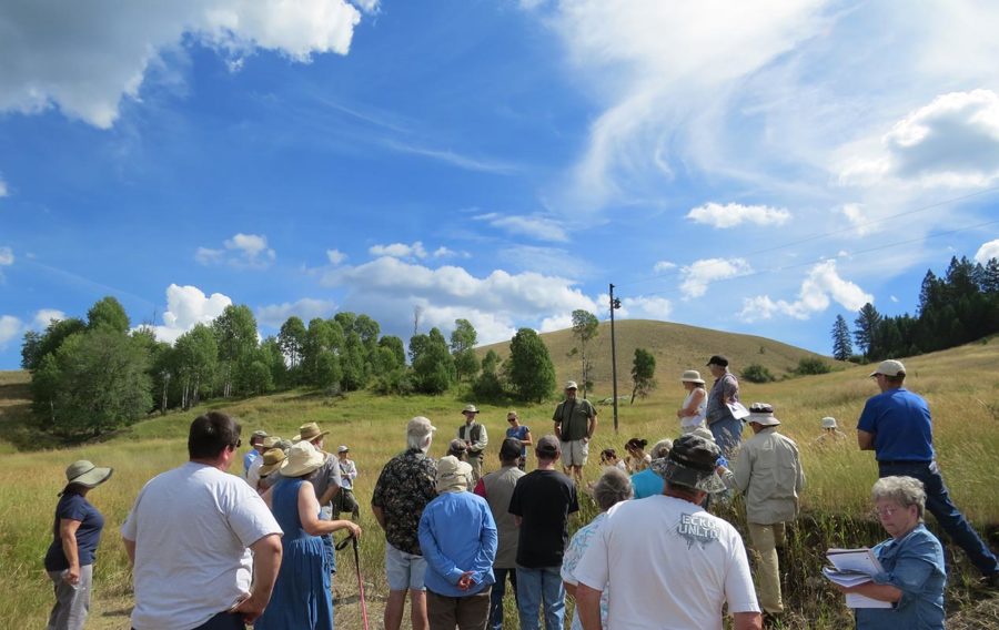
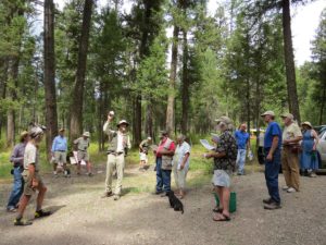
On August 17th, 2013, an extraordinary outdoor Highland Wonders event took place: a tour highlighting the geology of the highlands, expanding on what was shared during the past two years’ geology tours. Geology of the Okanogan Highlands – Part III, was lead by a team of speakers who each brought a different emphasis.
The Geology team was comprised of:
- Karl Lillquist, Professor, Geography Department; Co-Director, Resource Management Graduate Program, CWU; and Instructor for the Ellensburg Chapter of the Ice Age Floods Institute
- Ralph Dawes, Professor at Wenatchee Valley College; led the 2011 Highland Wonders geology tour and co-led in 2012
- Cheryl Dawes, Bachelor’s degree in Geology; assisted with previous Highland Wonders geology tours in 2011 and 2012
- Stephen Box, Research Geologist with the US Geological Survey; co-led the 2012 geology tour
The group examined rocks brought to North America from elsewhere and learned how they changed and became part of the structure of the highlands. The group also examined the “icing on the cake” effect of a sheet of moving glacial ice, thousands of feet thick, which sculpted the highlands and sprinkled them with sediments and erratic boulders. It is on this foundation that the modern flora and fauna of the highlands, including people, have established themselves and found their niches. There were lots of things to look at, think about, and make connections between as the group explores the special geology of the highlands.
“It’s wonderful to share time in the field with people whose interest in the highlands leads them to want to understand the geological story behind familiar landscape features,” says Dawes.
- Download the 2013 Field Trip Handout (139 KB)
- Download the 2013 Geology Tour Route – Aerial Map (360 KB)
- Download the 2013 Geology Tour Route – Geologic Map (1.1 MB)
Introduction
Two hundred million years ago, the area that is now the Okanogan Highlands was along the western edge of the North American continent. Since that time, three major geologic processes have shaped the area: terrane accretion, Eocene extension and volcanism, and glaciation.
Between 200 and 180 million years ago, volcanic islands built on oceanic crust were shoved onto the continent in the Highlands region in a process called accretion. Rocks added like this are called accreted terranes. Quesnellia is the largest accreted terrane in the Okanogan Highlands and the one that we will see rocks from on this tour.
Between 60 and 40 million years ago, the crust under the Okanogan Highlands was stretched and broken apart at the same time as volcanoes erupted in the area. Today we will see rocks representing the two ways these volcanoes erupted – as lava flows and as exploded bits and pieces. The stretching and breaking apart of the crust that occurred at this time created the definitive geologic structures of the Highlands, known as metamorphic core complexes (see stop 1) and grabens (see stop 4).
Between 2.6 million and 12,000 year ago, continental glaciers repeatedly advanced from the north over the region, reshaping the surface of the Okanogan Highlands. The glaciers smoothed the ridges and peaks, deposited flat layers of sediment on the valley bottoms, formed flat benches along the sides of the valleys, and created the system of lakes and streams that water the Highlands today.
The unique combination of bedrock, geologic structures, and glacial features create the wondrous landscape of the Okanogan Highlands.
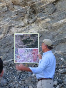
Stop 1: Amphibolite Gneiss Borrow Pit
Location: On Clarkson Mill Rd, 1.6 miles south of Tonasket (48° 40’ 56.27”N 119° 27’ 27.24”W)
Parking: Approach will be from the southern end of Clarkson Mill (48° 40’ 34.94”N 119° 28’ 02.13”W) in order to utilize the pullout on the right-hand side of the road heading north, just before the borrow pit.
Gneiss is a metamorphic rock that forms at high temperatures and pressures and is characterized by light and dark layers. This gneiss, the Tonasket Gneiss, is part of the Okanogan Metamorphic Core Complex. A metamorphic core complex is a zone of igneous and metamorphic rocks that were domed upward beneath a detachment fault.
This borrow pit is in the Okanogan fault zone, which forms the western border of the Okanogan Core Complex. Here in the borrow pit we are looking at igneous and metamorphic rock that have partly been turned into mylonite (from Greek for “milled rock”). The black rock is a type of metamorphic rock called amphibolite, which was basalt before it was metamorphosed and recrystallized at high temperatures and pressures in the earth’s crust. The light-colored rock is granite that cooled from melted rock that intruded into the amphibolite.
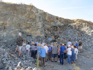
The granite became mylonite from the shear stress exerted by movement on the Okanogan fault. Mylonite is a type of metamorphic rock in which the minerals have been pervasively layered, elongated, and aligned by shearing. Look closely at the light-colored rock and you will see that it consists of common granite minerals (clear quartz, white feldspar, and black biotite) that have been recrystallized into parallel layers and lines.
Geologists think that it is not a coincidence that the Okanogan River valley follows the Okanogan fault zone from Canada to Omak. The river, as it eroded its valley, probably ended up following the zone of rock weakened by the fault. The hills on the west side of the Okanogan River consist of rocks that were above the Okanogan fault and slid off to the west. The “flat irons” that line the east side of the Okanogan valley between Riverside and Tonasket are made of mylonite from the zone below the fault that was sheared by the sliding.
Note: Refer to the field trip geologic map handout during explanation of the map in audio recording.
Stop 2: Ice Sheets and Kame Terraces
Location: Between Mileposts 273 and 274, just before Cayuse Mtn Road (48.66990, -119.22489)
Parking: Large paved pullout
Listen to a 14 minute audio clip from Stop 2 (10 MB, Karl Lillquist speaking)
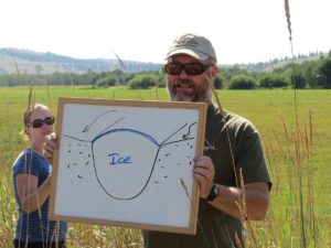
Starting as much as 2.6 million years ago, the Okanogan Highlands were covered several times by an ice sheet that flowed out of western Canada. The most recent ice sheet glaciation of the Highlands ended about 12,000 years ago and left many of the landscape features we see today. As the most recent ice sheet that covered the Okanogan Highlands stagnated and melted, remnant glaciers were left occupying the major valleys. Between the sides of the remnant glaciers and the valley walls, glacial meltwater deposited sand, gravel, and boulders, forming kame terraces. Kames are landforms deposited by flowing water adjacent to and partly in contact with glacial ice. Terraces at more than one elevation along a valley suggest that the glacier melted in stages.
See the article “Terraces in Okanogan County,” by Jack Holden
Stop 3: Moccasin Lake
Location: Wauconda (state land) (48.74289, -118.98775)
Parking: Ample space for bus to pull in facing the gate, cars alongside
Geologists passed samples around from outcropping just ahead on route (at 48.75161, -118.98769), of calcite marble that has been metamorphosed longer and more intensely than the marble at Chesaw (comparison/contrast). Just northwest of Moccasin Lake is a landform that may be a stranded delta formed when a side stream discharged into the temporary lake on the valley floor.
What is the origin of Moccasin Lake? It may be all that is left of a once larger lake in a glacially disrupted stream drainage. It may be a kettle lake, which is a lake in a hollow formed by sediment accumulating around a chunk of ice left from a glacier. Click here for an article on kettles, written by John Holden.
Drive-by stop leaving Moccasin Lake, from which samples will be shared: Outcrop of strongly foliated and lineated white marble. Foliated means it was layered during metamorphism. Lineated means that many of the minerals lined up, in this case in parallel lines that run steeply down the slope of the foliation layers. The rock used to be limestone, before it was metamorphosed – probably limestone from an accreted terrane. The Quesnellia terrane includes limestone deposits formed in a warm, shallow, tropical ocean over 200 million years ago, far from North America. In some parts of the Quesnellia terrane, the limestone contains fossils, which help narrow down its age to late Paleozoic to early Mesozoic (roughly between about 300 and 200 million years old). Here the limestone has been so strongly metamorphosed into marble, and so strained, that it has no fossils. Take a look at the sugary, shiny calcite crystals that make up this marble. From the quarry a mile or two to the north, relatively pure high-calcium marble is excavated, taken in trucks down to a train siding south of Tonasket, and loaded onto railroad cars to ship to a processing facility near Portland. The marble is used in paper whitening.
Stop 4: Bodie Townsite/Klondike Volcanic Outcrops
Location: Just before the historic townsite of Bodie (Park at 48.83175, -118.89762)
Parking: Park at 2nd pullout and backtrack, walking, to southern outcrop of andesite
The rocks in the Toroda Creek graben, like the Republic graben nearby to the southeast, largely consist of volcanic rock of Eocene age, about 48-57 million years old. The Toroda Creek and Republic grabens, eruption of the volcanic rocks, and formation of the Okanogan Metamorphic Core Complex, all overlap in time.
Though we don’t see it here, the Klondike Mountain Formation also contains layers of sedimentary rock, from places where streams and lakes became established during extended lulls in the volcanic eruptions. One example is the siltstone of the Stone Rose fossil quarry in Republic, in which many plant fossils (and a few fish and insect fossils) have been found, in sedimentary layers of the Klondike Mountain Formation.
Rock samples from the three volcanic units of the Toroda Creek graben will be passed around at lunch. To discuss the rocks, it will be helpful to understand a little volcanic rock terminology and the stratigraphic sequence of the local formations of volcanic rock:
tuff – rock made mostly of solidified volcanic ash
volcanic breccia – rock consisting of welded-together angular fragments of volcanic rock
volcanic ash – tiny shards of volcanic glass created by explosive eruptions
lapilli – volcanic particles larger than ash and smaller than breccia, often rounded
pyroclastic – describes explosive volcanic eruptions that hurl fragments into the air
volcaniclastic – describes volcanic material that has been redeposited after eruption, usually by flowing water
Eocene Volcanic Stratigraphy of Toroda Creek and Republic Grabens (youngest at top):
- Klondike Mountain Formation – lava flows, sedimentary layers, and volcanic breccia
- Sanpoil Volcanics – thick lava flows
- O’Brien Creek Formation – tuff, lapilli, volcaniclastic rocks, sedimentary rocks
The O’Brien Creek Formation is characterized by thick white layers of volcanic ash, crystals, lapilli, and other volcanic debris. Much of the volcanic debris in the O’Brien Creek Formation was volcaniclastic – it was redeposited by streams. The Sanpoil Volcanics are notable for thick lava flows that make steep slopes and high hills in the area including along the eastern portion of Beaver Creek. The Klondike Mountain Formation we see at Stop 4 is the youngest of the three formations of volcanic rock that fill the Toroda Creek graben.
Stop 5: Beth Lake Campground
Location: Beaver Canyon
Parking: Campground sites 13 and 14, no fee, day use permission granted. Bus should back into site #14; group can eat at #13. Go left, following sign for Campsites.
- Lunch and bathroom break
- Share samples of volcanic rock from outcroppings we have just driven by:
- samples from the Sanpoil Volcanics Lava Flow: (Lat/Long: 48° 51′ 33″ 118° 55′ 11″; GPS Lat/Long: 48.85901, 118.91974):
- samples from the O’Brien Creek Formation lapilli tuff (at Pontiac Ridge Rd) (Lat/Long: 48° 51′ 11″ 118° 56′ 58″; GPS Lat/Long: 48.85287, -118.94937)
Stop 6: Paleozoic Spectacle Formation Outcrop
Location: In Beaver Canyon, 2.8 miles beyond Beth Lake Campground; look for dead-top alder to mark the spot just beyond pullout; Milepost 26 (48° 53′ 16″N 119° 00′ 41″W)
Parking: Pullout on the right-hand side of road, just before the outcrop; group will walk along roadside to the outcrop
At this stop we see metamorphic rock of the Quesnellia terrane. The Quesnellia terrane was originally oceanic crust on which volcanoes built up into an island arc. Modern day examples of island arcs include Japan and the Aleutian Islands.
The variety of rock types in Quesnellia reflects the origin of the terrane. This variety includes ocean floor and island arc volcanics; intrusive igneous rocks, similar to granite, that solidified beneath the volcanoes; and a variety of seafloor sedimentary rocks including mudstone, sandstone and limestone. All this rock accreted to the edge of North America early in the Jurassic period (between 170 and 200 million years ago).
Stop 7: Granodiorite at the mouth of Beaver Canyon
Location: 1.8 miles from the previous stop, at Chesaw end of gorge, N. end of Pontiac Ridge Rd (48° 54′ 11″ 119° 02′ 16″)
Parking: Turn left into ample space across from the outcrop, in a driveway area marked with a political sign, “Smith,” across from Pontiac Ridge Rd.
The rock at Stop 7 is called granodiorite. This granodiorite is thought to be of Cretaceous age, between 65 and 145 million years old. The white mineral in the rock is plagioclase, the clear mineral is quartz, the flaky-sheeted black mineral is biotite, and the blocky black mineral is hornblende.
After Quesnellia had accreted and was part of North America, the subduction zone shifted farther west. Subduction produces magma, which intrudes the overlying crust and solidifies into large bodies of igneous rock such as granite. Granodiorite is a close relative of granite. Several bodies of granodiorite like this intruded Quesnellia during the Jurassic and Cretaceous periods, after the terrane had docked with North America.
Click here for the article, “Roche Moutonnée in the Okanogan,” by John Holden.
Stop 8: Marble Outcrop at Chesaw
Location: Just south of Chesaw at dramatic bend in the road (48° 56′ 25″ 119° 03′ 18″)
The rock here is marble of the Quesnellia terrane. Marble is metamorphosed limestone.
Stop 9: Hungry Hollow Hummocks
Location: Along Hungry Hollow Road between Chesaw and Havillah
The landscape we are looking at is associated with glacial meltwater and is known as “kame and kettle topography.” When the ice melts, a variety of topographically positive features appear depending on the original shape of these hollows . Conical hills reflecting roughly circular ice voids are kames while sinuous ridges known as eskers develop in sinuous former meltwater channels. Kame deltas are roughly circular but flat-topped deposits formed when subglacial meltwater channels emptied into subglacial lakes. As such, eskers are often associated with kame deltas. Finally, the depressions seen on kames and kame deltas are kettles, formed by the melting of chunks of glacial ice once buried in glacial drift.
While it does not appear to be true of these features, kames, eskers, and kame deltas are often the sites of quarries because of the associated well-sorted sands and gravels. Google Earth shows such a quarry north of our stop and just north of the Chesaw Road.
Stop 10: Antoine Creek Gorge Overlook and Gneiss Outcrop
(August 2013 group did not stop here on account of time limitations)
Location: Along Havillah Road (48° 46′ 27″ 119° 19′ 04″)
Parking: In pullout just after gneiss outcrop and near gorge overlook
Since the last glacial ice melted away (or possibly starting before then), Antoine Creek incised a steep gorge within a broader glaciated valley.
Tonasket Gneiss outcrops along the road: Compare the rock here with rock we saw at stop 1. Here the Tonasket Gneiss consists of several types of granitic rock that reflect various degrees of metamorphism and recrystallization into mylonite. Like the rocks we saw in the borrow pit, the rock here was caught up in the shear stress of the Okanogan detachment fault during the Eocene epoch. The fabrics and cross-cutting relationships in some of the light-colored, granitic rock in the outcrops at stop 10 indicate that the magma was intruding at the same time as the rock was undergoing metamorphism under high shear stress, turning into mylonite.
Driving Feature to notice after Stop 10: Antoine Valley Flat
Additional Resources
The following articles have been modified from the originals published in Okanogan County Heritage magazine by John C. (“Jack”) Holden. Jack developed these geological interpretations over the past several years during field trips throughout Okanogan County as a member of the “Friends Of the Okanogan Lobe” (FOOLs, for short). For more on the FOOLs go online: Rocks In Their Heads, Wenatchee World.
OHA thanks John “Jack” Holden for sharing the following updated articles, and Stephen Bingham for assisting with the layout and creation of revised PDF articles. These additions help OHA turn a one-day event into a lasting resource available online for the community.
- Introduction (102 KB)
- A Land Pocked With Kettles (553 KB)
- Erratics in Okanogan County (1.2 MB)
- Roche Moutonnée in the Okanogan (329 KB)
- Terraces in Okanogan County (447 KB)
OHA thanks the Geology 2013 team of leaders for their dedication in planning and implementing a high quality event tailored to the interests of our local community. Thank you, Karl, Steve, Ralph, and Cheryl!
education, events, field trip, geology, highland wonders, rocks