Surface Water | Water Year 2008-9

Since the Buckhorn Mine began operation in 2008, water quality monitoring data in surface water (as well as groundwater) have shown that mine contaminants are continuously escaping capture. The mine is required to capture and treat contaminated water. The mine has a permit to discharge water from the treatment facility and the treated water is relatively clean. However, the increased level of mine contaminants outside the mine is coming from unpermitted sources. Crown/Kinross has not established control of mine related contaminants, and the Buckhorn Mine continues to discharge contaminants in locations where no discharge is authorized, degrading surface and groundwater and even exceeding water quality standards.
OHA is concerned that unless action is taken soon, long-term protection of water resources may be jeopardized for current and future generations. Data shows that contaminants outside the mine boundaries in surface and groundwater remain elevated. OHA believes Crown/Kinross has the resources to deal with the problems.
Other Issues:
Evaluation of Mine Dewatering Impacts to Streamflow
- Difficult to accurately compare pre- to post-mine baseflow using current approach due to missing meteorological data for Buckhorn Mountain (WY 2008 & 2009). Comparison is needed to evaluate changes caused by mine dewatering.
- Faulty use of Moses Mountain precipitation data; no correlatation to Buckhorn Mountain.
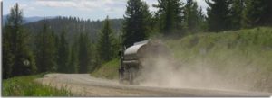
Transporting Water Out of Basin
Ecology is allowing Kinross to transport millions of gallons of the wastewater from the treatment facility, out of the Toroda Creek basin, to the Kettle River tailings impoundment, without a water right, because Ecology says Kinross is not putting the water to beneficial use. There has been no environmental review for this out of basin transfer, nor mitigation.
Recommendations
- Improve meteorological station at Buckhorn Mountain –Include snow depth and snow water equivalent (SWE) at two sites
- Generate correlated data for 08-09 using Buckhorn, Republic, or Molson precipitation data.
- Better gauging – add transducers
- Walk streams during lowest flow months
- Identify dry areas in reaches potentially affected by drawdown